Services

We are expanding our business portfolio to include drone services such as GIS, Videography, Inspections, Education, and other business services.  Explore our services portfolio below.

Mapping, Surveying, Aerial Inspection, Videography

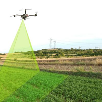
Mapping and Surveying with Drones

Drones gather geospatial data using specialized cameras and sensors for mapping and land analysis. They create 3D models and maps, aiding land surveys, infrastructure inspection, and precision agriculture. Drones offer cost-effective data collection benefiting diverse industries.

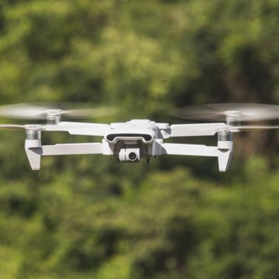
Aerial Inspection and Videography

Drones equipped with cameras and sensors conduct visual inspections and capture high-quality videos. Used in infrastructure, environmental assessment, and real estate, these drones offer a safe, efficient, and cost-effective way to inspect structures and record unique aerial perspectives.

Sale of UAVs/Drones

DJICaribbean.com provides a wide range of UAVs/drones suitable for hobbyists, professionals, and enterprises. Explore our drones tailored to meet industry-specific needs, ensuring quality and reliability.

Drone Payloads

Drone payloads encompass various equipment carried by drones for specific tasks. These payloads include cameras, sensors, delivery systems, communication devices, and more, catering to diverse applications from agriculture to mapping and stabilization systems.

Pilot Training for Drones/UAVs

Our UAVs/drone pilot simulation training suits novices and those seeking professional flight certification. No prior experience is required. It’s an ideal starting point for full drone pilot certification, offering varying flight plans from easy to challenging.