Drones gather geospatial data for mapping, surveying, and land analysis. Equipped with specialized cameras and sensors, they capture high-resolution images and videos to create 3D models, maps, and orthomosaic images. Drones aid in land surveys, infrastructure inspections, precision agriculture, and environmental monitoring. They offer cost-effective and rapid data collection, benefiting various industries in informed decision-making and resource management
Aerial Inspection and Videography
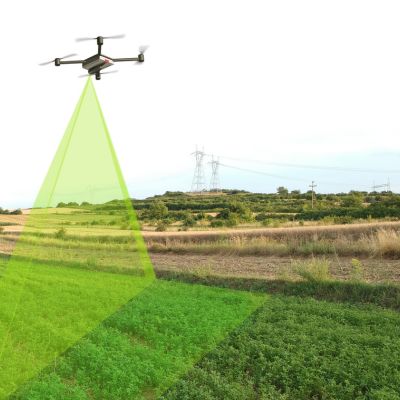
Drone aerial inspection and videography involve using unmanned aerial vehicles (UAVs) equipped with cameras and sensors to visually inspect structures, and capture high-quality videos, and imagery. They’re used in industries like infrastructure, environmental assessment, filmmaking, and real estate to conduct inspections, monitor environmental conditions, create cinematic shots, and showcase properties from above. These drones provide a safe, efficient, and cost-effective way to perform inspections, record footage, and capture unique aerial perspectives.